North and South Streams Peat Restoration Project
Location
Northbourne near Dover
Date
2024 – 2025
What we did
Kentish Stour Countryside Partnership worked with the River Stour
Internal Drainage Board https://rsidb.org.uk/ to raise and retain
local water levels, within the remnants of Kents lowland peat, to prevent
further peat degradation, reduce CO₂ emissions and enhance local
biodiversity. This project was funded through the Lowland Agricultural
Peat Small Infrastructure Pilot (LAPSIP) grant scheme, the remit of which
was the delivery of projects by internal drainage boards (IDBs)
to install new small-scale water level management infrastructure and
monitoring technology within drainage districts containing lowland
peat.
Main stop structures were installed on the North & South
Streams at the downstream end of the site.
A new feed structure was installed, designed to transfer
water from the higher South Stream to the North stream
via a central channel, most likely the original
watercourse through the site.
Six large woody dams were installed in the main channels,
three in North Stream and three in Broad Dyke.
Two smaller woody dams and one faggot dam were installed
in the central drainage channel by the Kentish Stour
Countryside Partnership Volunteer group.
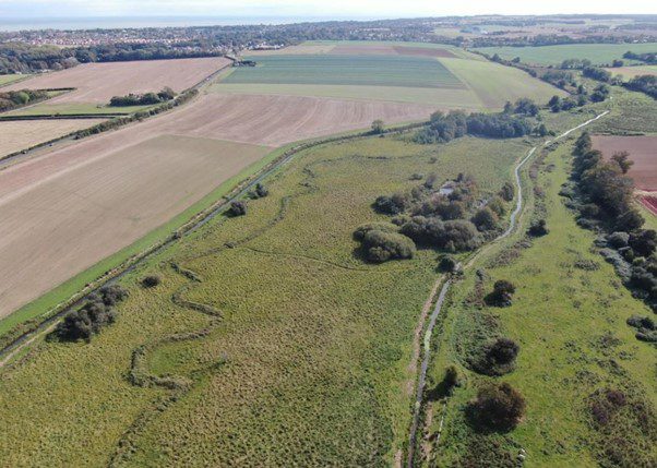
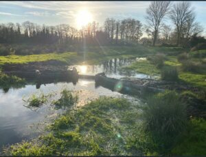
North and South Streams before works
Benefits
England’s peat deposits are one of our most valuable national assets.
They’re our largest carbon store, they filter most of our fresh water
and help defend communities against flooding, and they’re home to
irreplaceable plants and wildlife.
Kent is a very water-stressed county, with East Kent particularly affected.
The North & South Streams at Northbourne, near Deal, are part of a
Chalk Stream system, fed by groundwater springs and run-off from
surrounding farmland. These streams pass through a 168-hectare area of
deep lowland peat, historically known as ‘Brooklands’. The project area,
part of this historically significant fenland, has been subject to centuries
of drainage, intensive agriculture, and local coal mining, leading to substantial
peat shrinkage and loss of wetland habitats.
The primary objectives of the project were:
1. Peat Protection: To prevent further drying and degradation of the
peat by raising and retaining water levels, particularly during dry periods.
2. Biodiversity Enhancement: To create and enhance wetland habitats,
benefiting local flora and fauna, including rare species such as water voles
and beavers.
3. Carbon Emission Reduction: To reduce CO₂ emissions by rewetting the
peat, thereby preventing the release of stored carbon.
4. Flood Risk Management: To improve water retention in the landscape,
benefitting upstream use whilst reducing downstream flood risk during
periods of high rainfall.
5. Demonstration Site: To create a model for future peatland restoration
projects in Kent and beyond, showcasing the effectiveness of low-cost
interventions
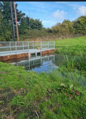
South Stream Stop Structure
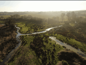
Broad Dyke Large Woody Dams in place holding summer waters high.
Broad Dyke Large Woody Dams
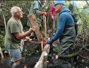
Volunteers build a small woody dam